
-
Home
- About Us
-
Our Services
Training and Opinion
Inspection
-
Higher Offices
Division / District
Ministry / Department
- e-Services
-
Gallery
Photo Galary
Video Galary
-
Contact
Official Contact
Contact map
-
Opinion
Opinions and recommendations
-
List of associations
Chitalmari Union
Charbaniyari Union
Barabaria Union
Santoshpur Union
Hijla Union
Kalatala Union
Shivpur Union
-
Supportive Information Services
Focal point officer
Chitalmari, Bagerhat at a glance.
General Information
District Bagerhat
Upazila Chitalmari
It is bounded by Madhumati river in the north, Nazirpur upazila of Pirojpur district in the east, Kachua and Bagerhat Sadar upazilas in the south and Mollahat upazila in the west.
Distance from District Headquarter is 22 kms.
The area is 192 square kilometers
Population 138810 (Approx.)
Male 69416 (Approx.)
Females 69394 (Approx.)
Population density 728 (per square kilometer)
Total number of voters is 88180 people
The number of male voters is 44656
The number of female voters is 43524
Annual population growth rate is 1.30%
Total household(s).
Constituency 95, Bagerhat-1
124 villages
Mouza 55
Union 07
There is no municipality
The orphanage is not official
Orphanage non-government 07
262 mosques
129 temples
3 rivers
Hat-bazar 15
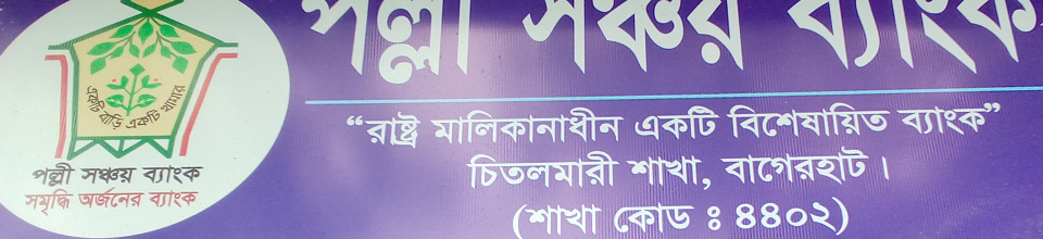
04 bank branches
Post Office/Sub Post Office 8
Telephone Exchange 01 t
17 small cottage industries
03 large industries
Agricultural
The total land area is 19,206 hectares
Net crop land is 1200 hectares
The total cultivated area is 23,700 hectares
One crop area is 5,300 hectares
7,700 hectares of two-crop land
1,000 hectares of three-crop land
No deep tube well
Non-deep wells 360 t
Power driven pump 4034 t
The base number is 10
Annual food demand is 29,600 million tonnes
Number of tube wells
Education related
105 Government Primary Schools
2 non-government primary schools
2 community primary schools
Junior High School 2
High School (co-education 24
High School (Girls) 5
Dakhil Madrasa 3
Alim Madrasa 1
Fazil Madrasa 3
There is no Kamil Madrasah
College (co-curricular) 03
College (Girls) 01
Education rate is 56.2%.
Male 57.5%
Female 54.9%
health related
Upazila Health Complex 01
There is no upazila health and family welfare center
The number of beds is 31
The sanctioned number of posts for doctors is 09
The number of working doctors is 03
Number of senior nurses is 10 people
No number of assistant nurses
Relating to Land and Revenue
Mouza 55
Union land office 04
There is no municipal land office
Total Khas land is 1100'72 acres
Agriculture 1090'74 acres
Non-agricultural 9'98 acres
Settled Agriculture 635'96 Acres (Agriculture)
Annual Land Development Tax (claim) General = 20,66,329/-
Organization = 95,120/-
Annual Land Development Tax (Revenue) General = 20,71,338/-
Organization = 37,308 /-
The number of market is 12
regarding communication
Paved road is 36.73 km
Half paved road
The unpaved road is 265'44 km
Number of bridges/culverts is 02
The number of rivers is 02
family planning
Health and Family Welfare Center 04
03 family planning clinics
M.C.H. no unit
The number of capable couples is
Fisheries
The number of ponds is 6,207
Fish seed production farm is not official
Fish Seed Production Farm Non-Government 01 t
Annual fish demand is 3,000 million tonnes
Annual fish production is 5,000 million tonnes
animal resources
Upazila Veterinary Center 01
The number of veterinarians is 01
Artificial reproduction center 01
The number of points is 06
The number of developed chicken farms is 37
800+ chickens per layer · 10-49 chickens, such farms are numerous.
14 cattle farms
27 broiler chicken farms
Regarding cooperatives
Central Cooperative Society Ltd. 01 T
Muktijoddha Cooperative Society Ltd. 02 t
Union Multipurpose Cooperative Society Ltd. 07
Multipurpose Cooperative Society Ltd. 24T
Fishermen Cooperative Society Ltd. 02 t
Youth Cooperative Society Ltd. No
Shelter/Housing Multipurpose Cooperative Society 01
Farmers Cooperative Society Ltd. 12
Purush Bittaheen Cooperative Society Ltd. 03 t
Mahila Bittaheen Cooperative Society Ltd. 01 t
Small Business Cooperative Society Ltd. 02 t
Other Cooperative Societies Ltd. 05
Driver Cooperative Society 1


Planning and Implementation: Cabinet Division, A2I, BCC, DoICT and BASIS
Technical Assistance:
![]()
Developed By:
